 Rus
RusThe information on this page is outdated. Please go to the home page and refresh it.
Historical and geographical reference
The Altai territory
The Altai territory is geographically located on northwest slopes of the Altai-Sayansk highland and the southeast suburb of the West Siberian Plain. Is the subject of the Russian Federation enters Siberian federal district. Administrative center of the Altai territory is the city of Barnaul. As a part of the Altai territory 11 cities, 30 settlements of city type. The Altai territory is educated on September 28, 1937 and borders on Novosibirsk, Kemerovo areas, Altai Republic and the Republic of Kazakhstan. For territories are allocated steppe and low-mountain natural areas: Kulunda Steppe, Ore Altai, Ob Plateau, foothills of Altai. As the most part of the territory of the Altai territory lies on the plain, for it small absolute heights are characteristic: from 79 m (lake Big Yarovoe) in the western part of Kulunda Steppe to 300-320 m in the southeast of Ob Plateau. In the extreme South the Altai territory closely rises to Middle mountains (the highest point - Royal white, 2298 m).
The climate
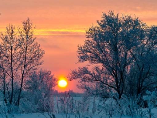
The climate of the Altai territory has pronounced lines of continentality: cold, long, snow winter and short, warm, sometimes hot summer. Under position of edge on 51-54 degrees of a northern latitude and by prevalence of anti-cyclones are created by favorable opportunities for arrival of a large number of a solar heat. The driest and hot is the western flat part of edge. To the East and the southeast there is an increase in a precipitation from 230 mm to 600 - 700 mm a year. Average annual temperature increases to the southwest of edge. Due to existence of a mountain barrier in the southeast of edge dominating West east transfer of air masses gets the southwest direction.
The water resources
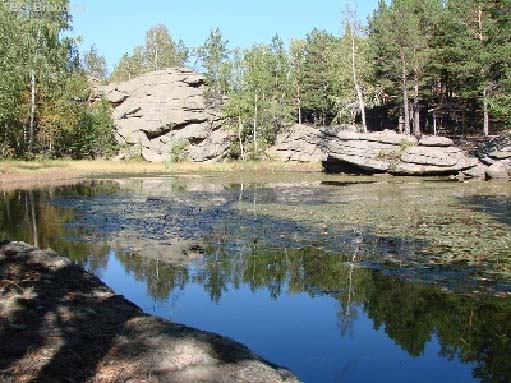
Water resources of the Altai territory are presented by surface and underground water. The largest rivers (from 17 thousand) - Ob, Biya, Katun, Chumysh, Aley and Charysh. From 13 thousand lakes the biggest - Lake Kulunda, its area is 728 sq km. The main waterway of the region - the river Ob - of limits of edge of 493 km, is formed from confluence of Biya and Katun. The basin of Ob occupies 70% of the territory of the region. In the Altai territory there are a lot of mineral sources, them over two thousand are. The balneal resort of Belokurikha is well-known the radon thermal waters.
Flora and fauna
The variety of zone and intrazonal landscapes of the Altai territory promotes a specific variety of fauna. In fauna of edge more than 320 bird species and 90 species of mammals are. Here grows about 2000 species of the highest vascular plants that makes two thirds of a specific variety of Western Siberia. Among them there are representatives the endemic and relic types. In the territory of the region there are 33 wildlife areas. Their total area makes 773.1 thousand hectares or less than 5% of the area of edge. 100 nature sanctuaries, from them 54 geological, 31 water, 14 botanical and 1 complex are approved.
Population
Population of edge according to Rosstat makes 2 390 638 people (2014). Population density - 14,23 people/sq.km (2014). Urban population - 55,68% (2013). In the Altai territory lives more than 100 nationalities: 94% of the population are made by the Russians following on number - Germans (2%), Ukrainians (1,4%); all the others - 3%.
Mineral resources
Minerals of the Altai territory include polymetals, table salt, soda, brown coal, nickel, cobalt, iron ore and precious metals. Altai is well-known for unique fields of a jasper, porphyries, marble, granites, ochre, mineral and drinking waters, natural medical dirt.
History of development
Ore Altai and regions of Mountain Altai adjoining to it since ancient times are one of the most important sources of ores of metals in the territory of Southwest Siberia and East Kazakhstan. The most ancient certificates on stone use in the territory of Altai for production of tools belong to a paleolith era (about 100-50 thousand years ago). In the 5-4th millennium production of clays for manufacture of ceramic ware began BC. Of particular importance Ore Altai is during a copper and bronze era when it becomes one of the largest centers of smelting of metals. Early copper-ore developments allegedly date in the 3rd millennium BC. Special scope is gained by mining works in the middle of the 2nd — the 1st half of the 1st millennium BC when ore bodies of the majority of the known nowadays copper, lead and tin fields coming to a surface were developed: Ridder-Sokolnoye (East Kazakhstan), Zolotushinskoye (Russia), Zyryanovskoye (East Kazakhstan), etc. Mainly oxidized copper ores and gold were extracted. Special value for ancient metallurgy not only Altai, but also huge territories of Northern Asia, and also Eastern Europe Kalbinskiye and Narymskiye had the tin mines located in the Irtysh collapse zone in the territory of East Kazakhstan.
Mining operations in a bronze age were conducted in the various ways: the continuous open spaces with working off of the richest sites of fields; pits (depth is up to 30 m) with local dredging of mineral veins; adits (to 70 m), the following strictly in the directions of ore veins. The driving of strong breeds was carried out with the help "пожога". In a face of development fire which led to thawing of permafrost and cracking of radical breeds was displayed. In the territory of Ore Altai tunnelling tools and tools for ore crushing are found: stone hammers, horn and bronze picks, wedges. Adits of ancient developments fastened a tree. Ore took out in leather bags. As ladders used wood trunks with notches or with the left boughs. Places of melting of copper and tin ores from which finds near villages Kanay and Trushnikovo (XVI-XIIVV BC) are the most known are known also . Not so long ago archeologists of the Altai state university found traces of roasting of copper ore on the bank of the lake of Kolyvanskoye in the settlement, dated about XX century BC. Decline copper and tin ore crafts is planned in the early Iron Age (the end of the 1st millennium BC — the 1st millennium AD). Probably, then development of iron ore fields though concrete data on ancient mines practically are absent begins.
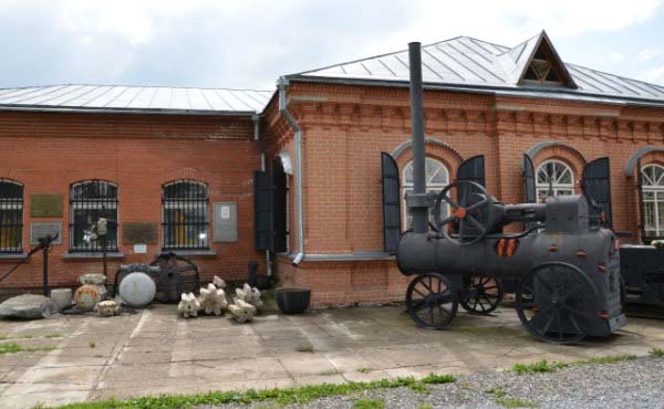
In the 20th of the 18th eyelid by the ore-expert of the Ural industrialist Akinfiya Demidov near the Kolyvansky lake the field of ores is opened and the copper-smelting plant is put Loktevsky (Kolyvano-Voskresensky) first in Altai, then there were Barnaul and Shulbinsky copper plants (1739-44). In 1736 on a place of ancient developments the ore-expert Fedor Lelesnov opened the richest field of silver on the Snake mountain. From this point conducts the chronology Zmeinogorsk, the city is obliged by the obliged glory and the world popularity to Zmeevsky mine where extracted silver and gold. More than 100 years the mine was the main supplier of gold and silver of Russia. Here about 8 million poods of silver ore were got and 1000 poods of golden silver were made. According to Catherine II order at old Loktevsky copper-smelting plant the grinding factory, nowadays Kolyvansky stone-cutting factory was founded. By the beginning of 19 century Altai took the 1st place in Russia on production and lead and silver smelting. Silver was taken out to Petersburg, and from copper since the 18th century at Suzunsky plant (nowadays the settlement Suzun, the Novosibirsk Region) minted "Siberian", and later all-Russian small change coins.
At the beginning of 1746 the decree about transfer of the Altai mines and plants to property of an imperial surname is issued. Despite remoteness from industrial areas in the Altai mountain district mining successfully developed. The village on the river Barnaulka occupied by workmen and miners, became in 1771 the city of Barnaul — control center of all mountain district. Within the XVIII-XIX centuries Zmeinogorsk was the large center of engineering thought in Altai. In the city there was a railroad – "pig-iron wheel-wire" on horse draft – with a first-ever railway viaduct, outstanding hydraulic engineering constructions for lifting of ore and water pumping out from excavations.
The beginning of research of Altai by russian scientists belongs to the 1st half of 18 century. In 1721 Altai was visited by D. G. Messersmidt, in 1734 — I. Gmelin, in 1771 — P. S. Pallas. P. A. Chikhachyov's (1842) geological researches, G. E. Shurovsky (1844) and engineers of Mountain department promoted expansion of mineral resources of steel works of Altai. The first geological map of Altai on the scale of about 1:1000000 was made by Chikhachyov and published in 1845 in Paris. In 1815 in the Revnevsky stone quarry the block of a jasper from which at Kolyvansky factory works more than two hundred people in 1831 — 1843 created to nineteen ton "The queen of vases" — the biggest vase in the world, since 1849 exposed in the Hermitage was taken. The vase from a green jasper is represented on the coat of arms of the Altai territory as a symbol of its natural riches and skillful masters. After a peasant reform 1861 mining in Altai started falling into decay. The present stage of development of mining industry in Ore Altai begins after October revolution 1917 when detailed studying of mineral resources of Ore Altai and adjacent territories of East Kazakhstan was carried out. During the period till 1985 a large number of mining and processing works worked at the territory of Ore Altai. Now in the Russian territory of Ore Altai mining operations on production of polymetallic ores, gold and silver are conducted.